")
Coastal Dynamics
")
Coastal Dynamics
")
Coastal Dynamics
")
")
")
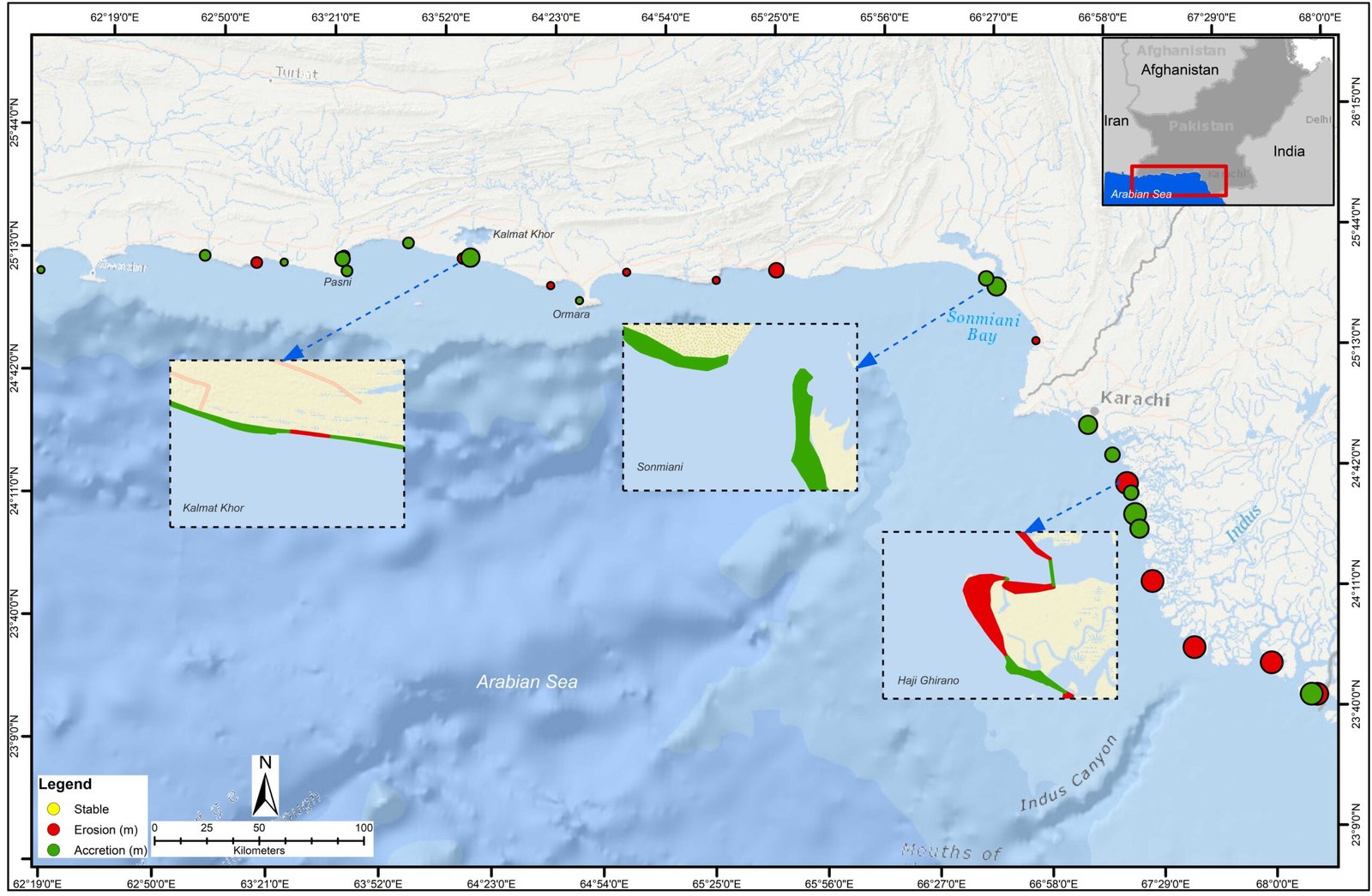
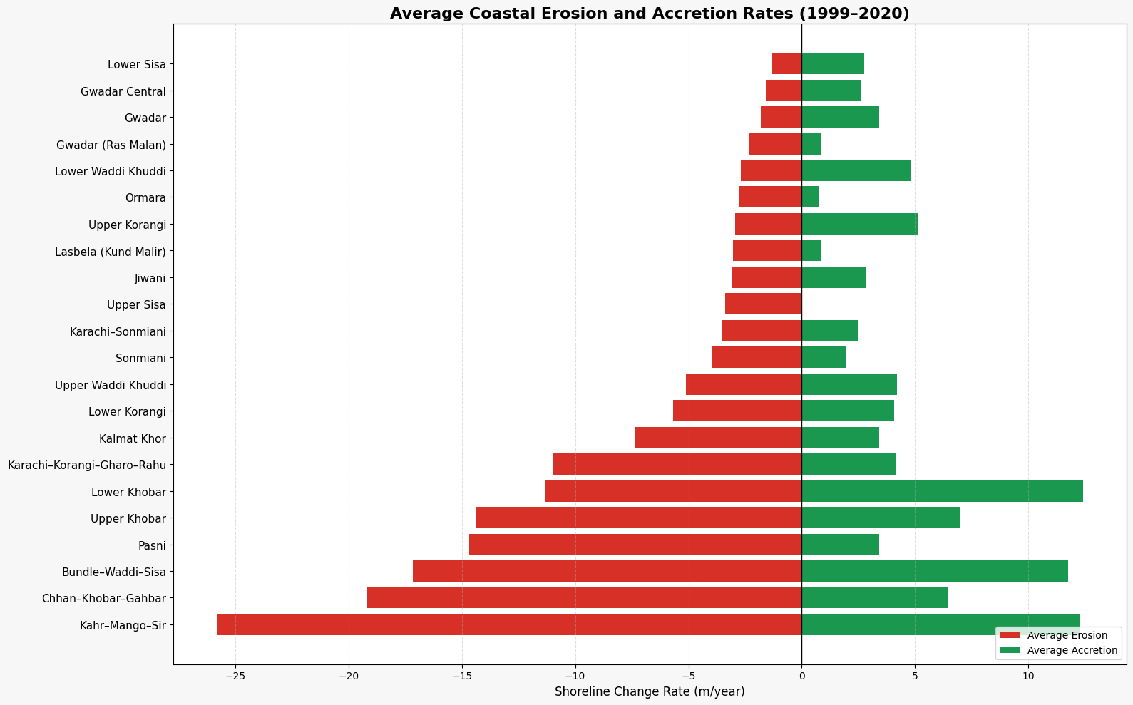
Pakistan’s coastline, extending approximately 1,001 km along the Sindh and Balochistan provinces, is shaped by dynamic interactions among waves, tides, currents, and sediment transport that sustain critical coastal ecosystems such as beaches, tidal creeks, deltas, and mangroves. These processes support biodiversity, fisheries productivity, and natural coastal protection. However, shoreline change along the coast is highly uneven. The Indus Delta (Sindh) is experiencing severe and widespread erosion, with northern deltaic creeks such as Kahr Creek, Mango Darya, and Sir Creek recording the highest retreat rates on the coast, reaching up to 100.98 m yr⁻¹ and averaging 25.82 m yr⁻¹. Central delta creeks also show substantial erosion (≈ 19.17 m yr⁻¹ on average), reflecting reduced sediment supply from the Indus River and increased marine influence.
In contrast, the Makran Coast (Balochistan) exhibits a mixed pattern of erosion and accretion. Pasni represents the most severe erosion hotspot, with retreat rates up to 82.02 m yr⁻¹, while areas such as Kalmat Khor, Gwadar, and Jiwani show strong local accretion despite mild average erosion, indicating active sediment redistribution. Other stretches, including Ormara and Sonmiani, experience moderate but persistent shoreline retreat. Overall, shoreline change between 1999 and 2020 highlights the dynamic and region-specific nature of coastal erosion and accretion in Pakistan, underscoring the importance of continuous monitoring to identify vulnerable zones, protect coastal ecosystems, and support climate-resilient coastal management.
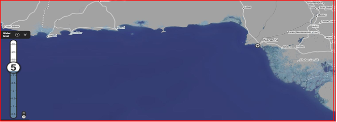
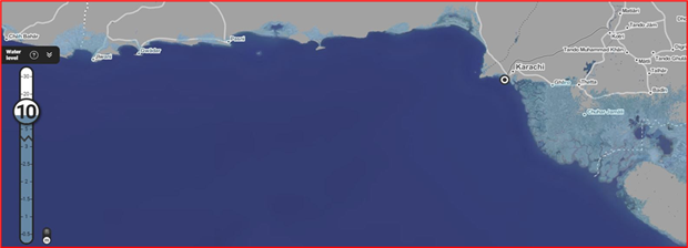
Sea-level rise assessment and modeling involve measuring, projecting, and analyzing changes in coastal water levels due to climate change, land subsidence, and other natural processes. By combining satellite altimetry, tide gauge data, and hydrodynamic models, these studies quantify current trends and forecast future scenarios, identifying vulnerable coastlines and low-lying communities. In Pakistan, such assessments are crucial for the Indus Delta and Makran Coast, where rising sea levels threaten mangroves, agricultural lands, and human settlements. Modeling outputs guide coastal planning, infrastructure design, and climate adaptation strategies, enabling policymakers to prioritize interventions, reduce flood risk, and enhance resilience of coastal ecosystems and communities.
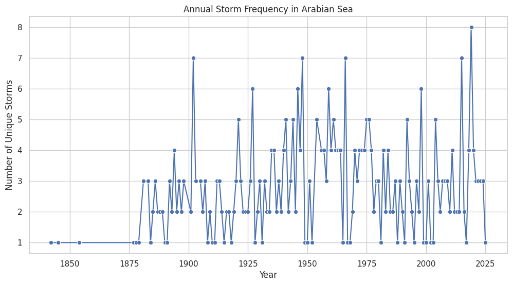
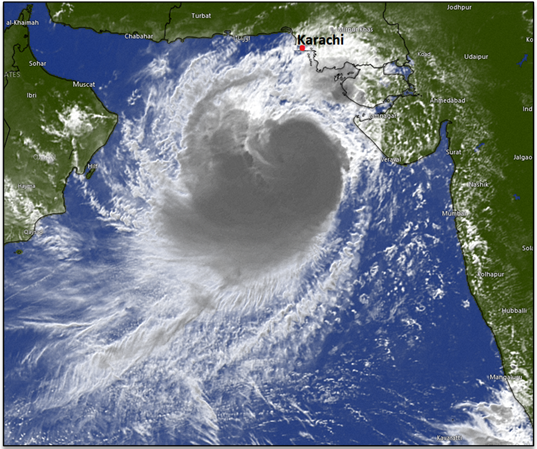
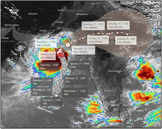
Storm frequency and intensity analysis involves studying historical and real-time data on cyclones, tropical storms, and extreme weather events to understand patterns, trends, and potential impacts on coastal regions. Along Pakistan’s coastline, particularly the Indus Delta and Makran Coast, such analyses are crucial for assessing the risk to human settlements, infrastructure, agriculture, and coastal ecosystems. By integrating satellite observations, meteorological records, and climate models, SUPARCO evaluates changes in storm occurrence, peak wind speeds, rainfall intensity, and sea level surges. This information supports early warning systems, disaster preparedness, and coastal management strategies, helping mitigate risks and enhance resilience of vulnerable communities and ecosystems against increasingly frequent and severe storms.
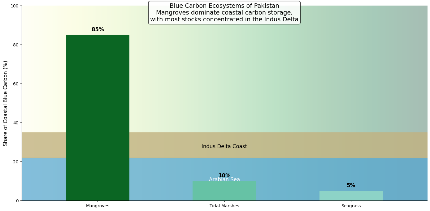
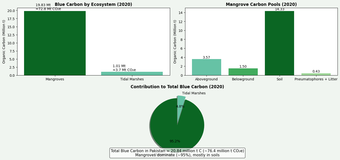
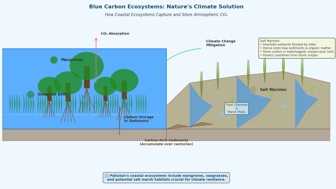
Mangrove & Coastal Habitat Mapping in Pakistan is carried out to systematically identify, classify, and monitor mangrove forests and associated coastal habitats using satellite remote sensing and geospatial analysis. SUPARCO employs multi-temporal satellite imagery to map the spatial extent, condition, and changes in mangroves, mudflats, tidal creeks, and adjacent coastal ecosystems along the Sindh and Balochistan coasts. This mapping enables the detection of habitat loss, degradation, and regeneration trends, particularly in the Indus Delta, where mangroves play a critical role in shoreline stabilization, carbon storage, and biodiversity support. The generated habitat maps support coastal zone management, conservation planning, climate reporting, and restoration initiatives by providing consistent, science-based spatial information on Pakistan’s coastal ecosystems.
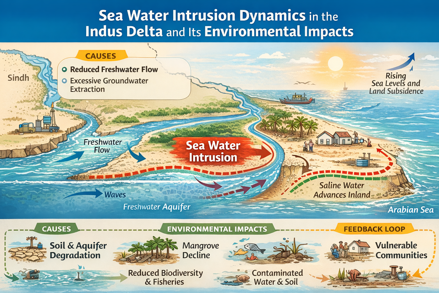
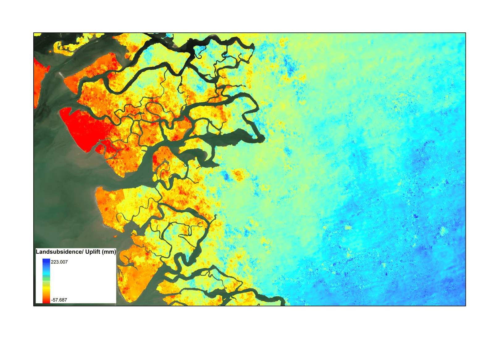
In Pakistan, SUPARCO monitors land subsidence to identify areas where the ground is sinking due to excessive groundwater extraction, natural sediment compaction, and tectonic activity. Using satellite-based Interferometric Synthetic Aperture Radar (InSAR) and high-precision GNSS stations, SUPARCO measures vertical land movements with millimeter-level accuracy over time. This monitoring is particularly critical in coastal and deltaic regions, such as the Indus Delta and urban centers, where subsidence can exacerbate flooding, accelerate seawater intrusion into freshwater aquifers, and threaten infrastructure. By generating detailed subsidence maps and time-series analyses, SUPARCO provides essential data for groundwater management, urban planning, and climate adaptation, supporting strategies to mitigate long-term environmental, economic, and social risks along vulnerable coastal zones.
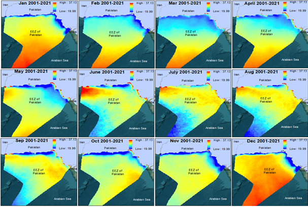
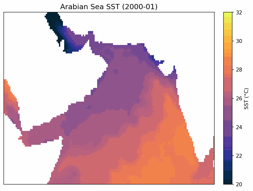
SUPARCO monitors sea surface temperature (SST), chlorophylla concentration, and salinity along Pakistan’s coastal and marine waters to assess the physical, biological, and chemical status of the ocean. SST data help track thermal variations and climate-driven changes, chlorophylla indicates phytoplankton productivity and overall ecosystem health, and salinity measurements reveal freshwater inflows, seawater intrusion, and coastal water quality. By combining satellite remote sensing with in-situ observations, SUPARCO provides continuous, large-scale monitoring that supports sustainable management of fisheries, early warning for harmful algal blooms, evaluation of ecosystem health, and informed climate adaptation planning along the Sindh and Balochistan coasts.
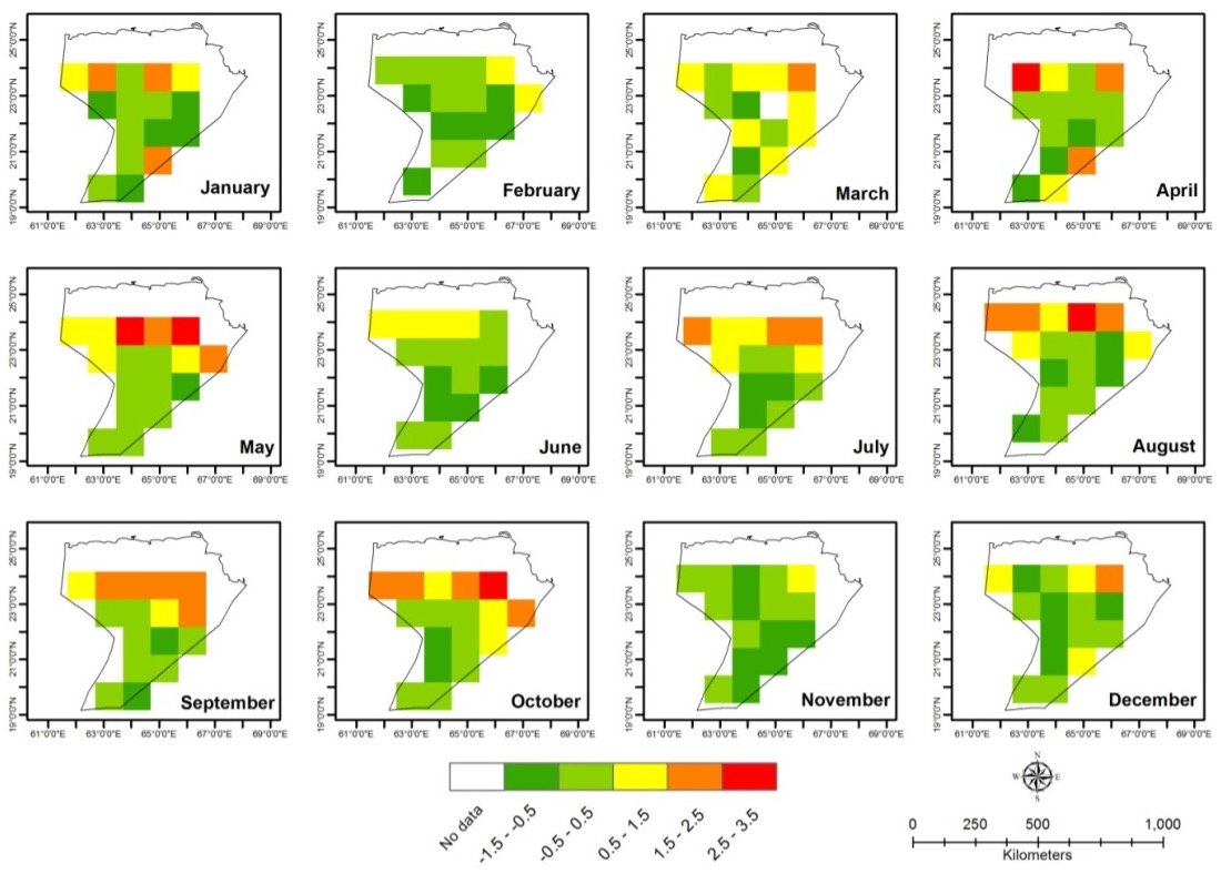
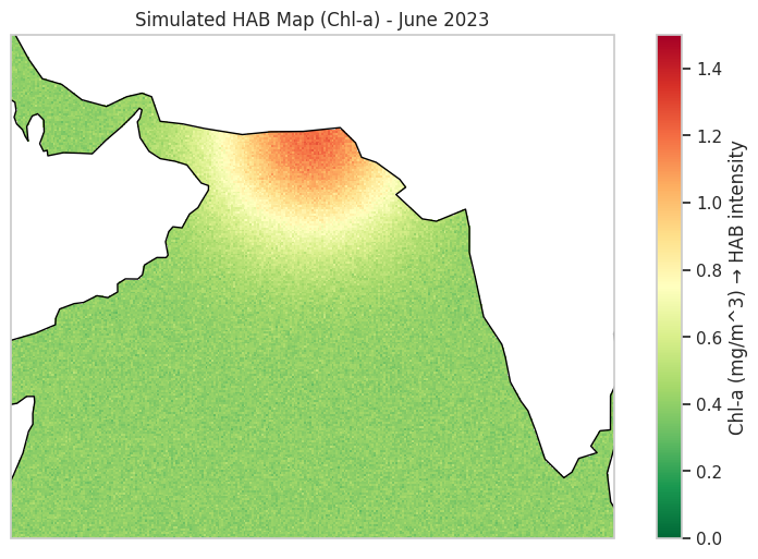
In Pakistan, SUPARCO plays a key role in the detection and monitoring of Harmful Algal Blooms (HABs) along the country’s coastal waters in the Arabian Sea. Using satellite-based Earth observation data, SUPARCO monitors ocean color, chlorophyll-a concentration, sea surface temperature, and turbidity to identify anomalous phytoplankton blooms that may indicate HAB events. These observations are integrated with oceanographic and meteorological data to assess bloom development, intensity, and spatial extent, particularly along the Sindh and Balochistan coasts where fisheries and coastal communities are most vulnerable. By providing early warnings and spatial assessments of potential HAB outbreaks, SUPARCO supports fisheries management, coastal monitoring, and environmental protection efforts, helping to reduce risks to marine ecosystems, seafood safety, and public health in Pakistan.
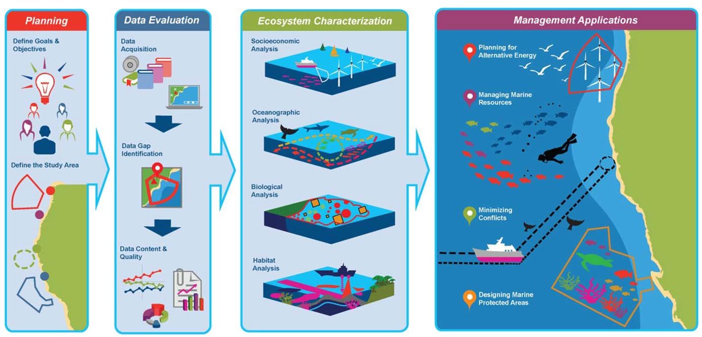
Marine Spatial Planning (MSP) Support Systems provide a structured, science-based framework for organizing human activities in coastal and marine waters to achieve environmental, economic, and social objectives. MSP involves analyzing and allocating the spatial and temporal distribution of maritime uses such as fishing, aquaculture, shipping, energy, and conservation to balance development demands with ecosystem protection and sustainable resource use. By integrating ecological data, socio-economic information, and stakeholder priorities into decision support tools, MSP systems help reduce conflicts between sectors, promote coordinated ocean governance, and enhance resilience of marine and coastal ecosystems to pressures such as climate change and overexploitation. In practice, these systems support evidence-based planning, improve transparency in marine management, and contribute to achieving ecosystem-based management goals and sustainable blue economy outcomes.